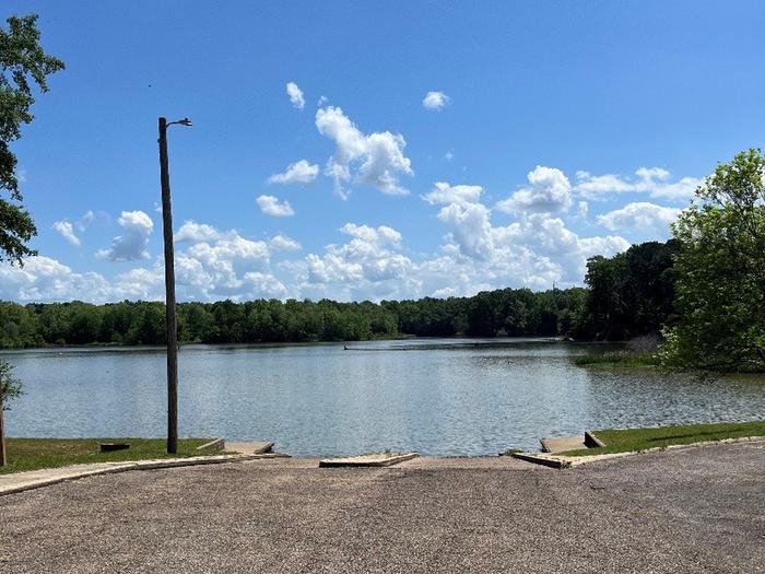
WAVERLY FERRY BOAT RAMP
on TENNESSEE - TOMBIGBEE WATERWAY — Clay County, Mississippi
- 2 lanes
- Concrete
Can I launch today?
Nearest gauge: TOMBIGBEE RIVER AT STENNIS LOCK AND DAM, MS — 3.4 mi away.
Water level
Reading the gauge…
Flow
A gauge reading describes the gauge, not the ramp. Conditions at the water can differ — confirm with the managing agency before you travel.
Details
| Water body | TENNESSEE - TOMBIGBEE WATERWAY |
|---|---|
| County | Clay |
| Type | boatRamp |
| Ramp surface | concrete |
| Launch lanes | 2 |
| Managed by | US Army Corps of Engineers |
| Agency | USACE |
Only fields the managing agency publishes are shown. A missing row means the agency does not record it, not that the feature is absent.
Directions to 33.56647, -88.49675 →
Other launches on TENNESSEE - TOMBIGBEE WATERWAY
We list 21 public launch sites on this water body. See them all →
Nearest boat ramps
- DEWAYNE HAYES CAMPGROUND BOAT RAMPTENNESSEE - TOMBIGBEE WATERWAY · 2.1 mi
- CHARLES YOUNGER LANDING BOAT RAMPTENNESSEE - TOMBIGBEE WATERWAY · 2.9 mi
- DeWayne Hayes Day Use Boat Ramp3 mi
- TOWN CREEK BOAT RAMPTENNESSEE - TOMBIGBEE WATERWAY · 3.2 mi
- STENNIS EAST BANK BOAT RAMPTENNESSEE - TOMBIGBEE WATERWAY · 3.2 mi
- ABERDEEN WEST BANK BOAT RAMP LANE ROADTENNESSEE - TOMBIGBEE WATERWAY · 17.7 mi
- BLUE BLUFF DAY USE BOAT RAMPTENNESSEE - TOMBIGBEE WATERWAY · 18.9 mi
- BLUE BLUFF CAMPGROUND BOAT RAMPTENNESSEE - TOMBIGBEE WATERWAY · 19.7 mi